


")
")
")
")
")
")
Լեռ
2299 մ
Բնական
Միջին
📍 Վայրը - Կոտայքի մարզ, Ֆանտան գյուղից 2,5-3 կմ հարավ և Ջրաբեր գյուղից մոտ 4 կմ հյուսիս-արևելք։
🕰️ Ժամանակաշրջան Պլիոցենի դարաշրջան․ լեռը ձևավորվել է հրաբխային լավաների և խարամների հոսքերի արդյունքում։
🌐 Կոորդինատներ - 40.3343° N, 44.6625° E
🌿 Այցելելու լավագույն ժամանակահատվածը - Գարնան և աշնան ամիսներին (ապրիլ-հոկտեմբեր), երբ գույները առավել հագեցած են, իսկ եղանակը՝ մեղմ։
🛤️ Ինչպես հասնել - Երևանից կարելի է հասնել Կոտայքի մարզով՝ անցնելով Աբովյան և Եղվարդ քաղաքները, այնուհետև Ֆանտան գյուղը։ Գյուղից դեպի լեռը ճանապարհը մոտ 3 կմ է, որը կարելի է անցնել քայլարշավով կամ ամենագնացով։
ԱԿՆԱՐԿ
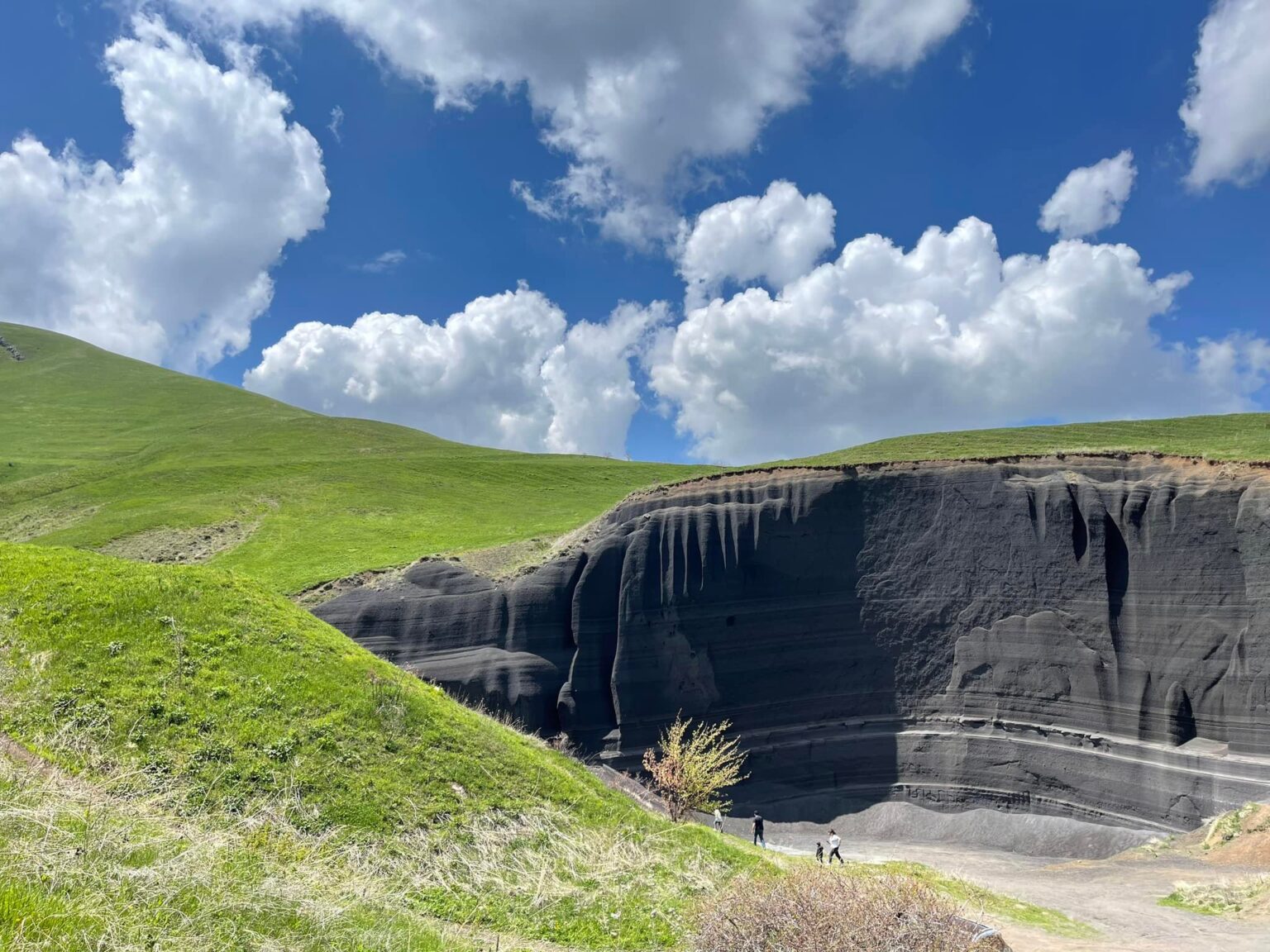
Գութանասարը Գեղամա լեռնաշղթայի արևմտյան հատվածում գտնվող հանգած հրաբուխ է՝ համաչափ կոնաձև տեսքով և պահպանված խառնարանով։ Լեռան բարձրությունը 2299 մ է, կազմված է պլիոցենյան լավաներից և խարամներից, իսկ հարավային լանջից բացվում է ճեղքվածք, որը ժամանակին եղել է լավայի հոսքի ուղղությունը։ Տարածքում կան պեռլիտի և պեմզայի պաշարներ, որոնք վկայում են լեռան հրաբխային ծագման մասին։
Գութանասարի ավազներ կոչվող վայրը, որը գտնվում է լեռան մոտակայքում և արդեն իսկ դարձել է գրավիչ զբոսաշրջային վայր, յուրօրինակ բնական լանդշաֆտ է, որը ձևավորվել է հազարավոր տարիների ընթացքում՝ հրաբխային ապարների քայքայման և քամու ազդեցության արդյունքում։ Այստեղ առաջացած ավազային շերտերը արևի լույսի անկյան փոփոխության ազդեցությամբ ստեղծում են յուրօրինակ գունային խաղ, որի արդյունքում լանդշաֆտի երանգներն անընդհատ փոխվում են, ստեղծելով տպավորիչ տեսարան, որը գրավում է ինչպես բնասերներին, այնպես էլ լուսանկարիչներին։
ԱՆՎԱՆ ԾԱԳՈՒՄՆԱԲԱՆՈՒԹՅՈՒՆԸ
Համաձայն ժողովրդական մեկնաբանության տարբերակներից մեկի՝ լեռն իր անունը ստացել է արտաքին ձևից` վերևից դիտելիս նրա գագաթի և լանջերի կորագիծը հիշեցնում է հողը վարելու գործիք՝ գութան։ Ըստ մեկ այլ մեկնաբանության՝ «գութան» արմատը կապված է հողագործության գործիք - խորհրդանիշի հետ, քանի որ Գութանասարի շրջակայքը դարեր շարունակ օգտագործվել է որպես արոտավայր և մշակվող հողերի տարածք։
ՊԱՏՄՈՒԹՅՈՒՆ
Լեռը ձևավորվել է մոտ երկու-երեք միլիոն տարի առաջ։ Խորհրդային տարիներին այն ուսումնասիրվել է որպես պեմզայի և պեռլիտի արդյունահանման պոտենցիալ վայր, սակայն արդյունաբերական շահագործում չի իրականացվել՝ տարածքի բնական գեղեցկությունը պահպանելու նպատակով։
շահագործում չի իրականացվել՝ տարածքի բնական գեղեցկությունը պահպանելու նպատակով։ Գութանասարի տարածքում հստակ նկատվում են էրոզիոն գործընթացների ազդեցությունները․ քամին, անձրևաջրերը և հողի շարժը հազարավոր տարիների ընթացքում ձևավորել են յուրահատուկ ավազային և հողային շերտեր։ Այս գունային խաղը պայմանավորված է հանքային բաղադրության տարբերությամբ՝ երկաթի, մանգանի և օքսիդների տարբեր համադրություններով։ Գութանասարի շրջակայքում գտնվել են հնագույն կենցաղային ու քարե գործիքներ, ինչը հուշում է, որ տարածքը բնակեցված է եղել դեռևս նախապատմական ժամանակներից։ Դրա շնորհիվ լեռը դիտվում է ոչ միայն որպես բնական, այլև հնագիտական հետաքրքրության վայր։
Այսօր Գութանասարը դիտվում է որպես էկո- և երկրաբանական տուրիզմի ուղղություն։ Այստեղ հաճախ են գալիս ուսանողներ ու գիտնականներ դաշտային ուսումնասիրությունների համար, իսկ լուսանկարիչներն այն օգտագործում են որպես եզակի բնական ֆոն՝ գունային շերտերի բազմազանության պատճառով։
Գութանասարի հարավային լանջին է գտնվում «Սև պատը»՝ հրաբխային միջուկի բաց հատվածը, որը ցույց է տալիս նախկին լավայի հոսքի ուղղությունն ու շերտերի կառուցվածքը։ Այն կարելի է համարել Գութանասարի կառուցվածքի մաս․ մասնավորապես՝ այն ձևավորվել է հրաբխային լավայի հոսքի ընթացքում, երբ մգացված (բազալտային) լավան սառել է և կոշտացել՝ ստեղծելով մուգ գույնի քարաշերտերի բնական պատ։
ՖԼՈՐԱ և ՖԱՈՒՆԱ
Գութանասարի շրջակայքը բնորոշվում է լեռնատափաստանային և մասամբ լեռնամարգագետնային լանդշաֆտներով։ Լեռան ստորոտին տարածված են չոր տափաստանային բուսատեսակներ՝ վայրի ցորենազգիներ, երիցուկ, կակաչ և եղեսպակ, իսկ բարձրադիր գոտիներում աճում են մարգագետնային խոտեր, վայրի փափախախոտ և դեղաբույսեր՝ ուրց, ծիրանի խոտ, գիշերաշուշան։ Գարնանն ու վաղ ամռանը լանջերը ծածկվում են բազմագույն ծաղիկներով՝ ստեղծելով գունագեղ տեսարան։
Կենդանական աշխարհում հանդիպում են լեռնատափաստանային տեսակներ՝ նապաստակ, աղվես, փշաքաղ, ինչպես նաև թռչուններ՝ աղավնի, բազե, լեռան ճնճղուկ, երբեմն էլ կարելի է նկատել հովազի և վայրի կատվի հետքեր։ Տարածքը հարուստ է թիթեռներով և միջատներով, որոնց բազմազանությունն առավել նկատելի է գարնան ամիսներին։
ԶԲՈՍԱՇՐՋՈՒԹՅՈՒՆ
Գութանասարը և նրա ավազային տարածքը վերջին տարիներին դարձել են հետաքրքիր ուղղություն բնության, էկո- և արշավային տուրիզմի սիրահարների համար։ Տարածքը հարմար է կարճ և միջին երկարության քայլարշավների, լուսանկարչական տուրերի և բնության դիտարկումների համար։
Չնայած որ Գութանասարի քայլարշավն ինքն իրենով մեկ ամբողջական օրվա զբոսանք է, այնուամենայնիվ ցանկության դեպքում այն հնարավոր է համադրել նաև Նեղուցի վանքի, Թեղենյաց վանքի կամ Արզականի Սբ Թադևոս եկեղեցու այցելության հետ՝ ձևավորելով ուղևորություն, որը միավորում է Հայաստանի բնությունը, պատմամշակութային ժառանգությունը և գեղեցիկ լեռնային տեսարանները։
ՏԵՂԱԿԱՆ ԼԵԳԵՆԴՆԵՐ
Գութանասարի հետ կապված լայնորեն հայտնի կամ գրավոր պահպանված լեգենդներ չկան, սակայն տեղական համայնքներում՝ հատկապես Կոտայքի մարզի գյուղերում, պահպանվել են բերանացի պատմություններ և հավատալիքներ, որոնք սարը կապում են հնագույն ժամանակների ու խորհրդավոր երևույթների հետ։
Դրանցից մեկի համաձայն՝ գյուղացիները հավատում են, որ Գութանասարի լանջերից հոսող ջրերը բուժիչ ուժ ունեն։ Նրանց պատկերացմամբ՝ լեռը կենդանի է, և յուրաքանչյուր ամպրոպից հետո նրա ներսում նոր ջրային աղբյուր է «բացվում»։ Այդ պատճառով էլ մարդիկ երկար ժամանակ խմել են միայն Գութանասարի աղբյուրներից՝ հավատալով, որ դրանք տալիս են ուժ և պաշտպանում հիվանդություններից։
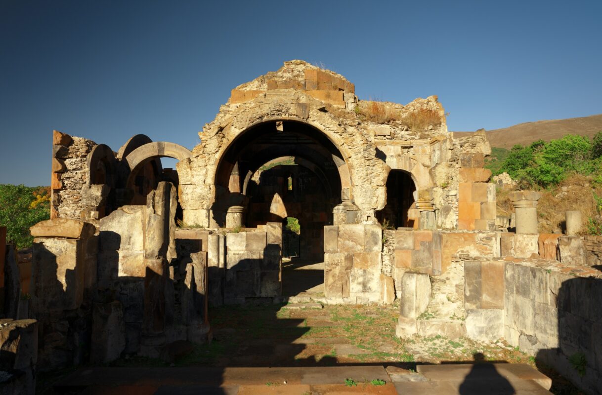
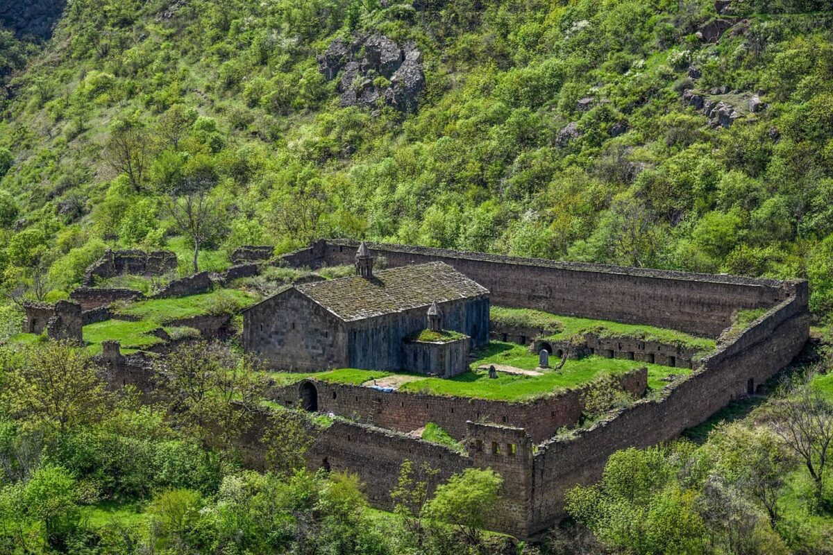
Միջնադարյան վանական համալիր Կոտայքի մարզում՝ Նեղուց գյուղի տարածքում։ Կառուցված է բազալտե քարերով և շրջապատված է խիտ անտառներով։ Վանքը հայտնի է իր համեստ, բայց ներդաշնակ ճարտարապետությամբ և լեռների հանդարտ տեսարաններով։
Հնագույն վանական համալիր, որը գտնվում է Թեղենիս լեռան լանջին՝ անտառներով ու աղբյուրներով հարուստ միջավայրում։ Հիմնադրվել է միջնադարում և եղել է հոգևոր ու կրթական կենտրոն։ Վանքի տաճարը աչքի է ընկնում իր կոկիկ քարաշենությամբ և բնության հետ ներդաշնակությամբ։
Վաղ միջնադարյան եկեղեցի Արգել գյուղում՝ կառուցված տեղական տուֆով։ Եկեղեցին միանավ, պարզ, բայց արտահայտիչ կառույց է, որը պահպանել է իր ձևը դարերի ընթացքում և շարունակում է մնալ համայնքի հոգևոր կենտրոն։
Վանքը թվագրվում է 13-րդ դարով և ներկայացնում է խաչաձև գմբեթավոր տիպի կառույց, կառուցված մոխրագույն տուֆով։ Շրջապատված է անտառային լանջերով և լեռնային հանգստավետ միջավայրով։ Տարածքում պահպանվել են նաև խաչքարեր և շինության մնացորդներ, որոնք վկայում են, որ վանական համալիրը եղել է միջնադարյան հոգևոր և համայնքային կյանքի կենտրոն։
Բնական հանքային աղբյուրներ՝ միջինում +32-36°C ջերմաստիճանով, հարուստ օգտակար միկրոտարրերով։ Գտնվում են Արզական գյուղի մոտակայքում և հայտնի են իրենց բուժիչ հատկություններով ու հանգստարար միջավայրով։
✓ Տևողությունը՝ անսահմանափակ
✓ Հիմնական կոնտակտային տվյալներ՝
✓ Սահմանափակ զտիչներ
✓ Նորությունների ծանուցումներ
✓ Տևողությունը՝ 6 ամիս
✓ Ներառում է մանրամասն տեղեկատվություն`
✓ Նորությունների ծանուցումներ
✓ Ընդլայնված զտիչներ
AMD 40,000
✓ Տևողությունը՝ 12 ամիս
✓ Ներառում է մանրամասն տեղեկատվություն`
✓ Նորությունների ծանուցումներ
✓ Ընդլայնված զտիչներ
✓ 20% զեղչ առաջին տարվա համար
AMD 75,000
Պատասխանատվության իրազեկում Հայկական տուրիստական տեղեկատու կայքի համար
«Հայկական տուրիստական տեղեկատուն» տրամադրում է հարթակ զբոսաշրջության հետ կապված բիզնեսների, այդ թվում՝ հյուրանոցների, տուրիստական գործակալությունների և գիդերի համար՝ իրենց ծառայությունները ներկայացնելու համար։ Կայքում տեղադրված տեղեկատվությունը տրամադրվում է երրորդ կողմի գովազդատուների կողմից, և Հայկական տուրիստական տեղեկատուն պատասխանատվություն չի կրում կայքում առկա բովանդակության կամ ծառայությունների որակի համար։
Հայկական տուրիստական տեղեկատուն պատասխանատվություն չի կրում կայքում առկա բովանդակության կամ ծառայությունների օգտագործումից կամ դրանց անհասանելիությունից առաջացած ուղղակի, անուղղակի, պատահական կամ հետևանքային վնասների համար։ Ընկերությունը չի երաշխավորում կայքում տեղադրված որևէ բիզնեսի կամ ծառայության մատչելիությունը, որակը, անվտանգությունը, օրինականությունը կամ համապատասխանությունը։ Օգտատերերը շփվում են գովազդատուների հետ սեփական ռիսկով։
Գովազդատուները բացառապես պատասխանատու են իրենց տրամադրած տեղեկատվության ճշգրտության համար, ներառյալ՝ նկարագրությունները, պատկերները և այլ բովանդակությունը, որը վերաբերում է իրենց բիզնեսին։ Հայկական տուրիստական տեղեկատուում ներկայացված ծառայությունների կամ բիզնեսների հետ կապված ցանկացած վեճ, պահանջ կամ իրավական խնդիր պետք է լուծվի անմիջապես օգտատիրոջ և գովազդատուի միջև։ Հարթակը չի մասնակցում վեճերի կարգավորմանը և որևէ պատասխանատվություն չի կրում դրանց լուծման համար։
Հայկական տուրիստական տեղեկատու կայքում կարող են լինել այլ կայքերի հղումներ, որոնք չեն կառավարվում կամ վերահսկվում ընկերության կողմից։ Ընկերությունը պատասխանատվություն չի կրում երրորդ կողմի կայքերի բովանդակության, գաղտնիության քաղաքականության կամ գործունեության համար։
Հայկական տուրիստական տեղեկատուն իրավունք ունի ցանկացած պահի առանց նախնական ծանուցման փոփոխել, թարմացնել կամ հեռացնել կայքում առկա բովանդակությունը։ Գովազդատուներին խորհուրդ է տրվում պարբերաբար ստուգել կայքը՝ վերջին տեղեկությունների և թարմացումների համար։
Օգտատերերը և գովազդատուները պարտավոր են պահպանել կայքի օգտագործման համար կիրառելի բոլոր օրենքներն ու կանոնակարգերը։ Հայկական տուրիստական տեղեկատուն պատասխանատվություն չի կրում օգտատերերի կամ գովազդատուների կողմից իրականացված խախտումների համար, ներառյալ՝ խարդախությունը, կեղծ տեղեկատվության տրամադրումը կամ օրինական պարտավորությունների խախտումը։
Հայկական տուրիստական տեղեկատուի վրա տեղադրված բոլոր ապրանքային նշանները, լոգոները, դիզայնի տարրերը և այլ նյութերը ընկերության սեփականությունն են։ Այս նյութերի չարտոնված օգտագործումը, վերարտադրությունը կամ տարածումը խստիվ արգելվում է։
Օգտագործելով Հայկական տուրիստական տեղեկատու կայքը, օգտատերերն ու գովազդատուները հաստատում են, որ հասկանում և համաձայնում են վերոնշյալ սկզբունքների հետ։